By Joanne Conley, Special to The Chronicle

An early morning jaunt to the area’s newest hiking trail? Yes, please!
When offered the opportunity to hike the new trail up Swede Mountain to the fire tower, I was quick to say yes! Built in 1918 and in service until 1968, this fire tower was purchased by Warren County in 1995 to use as a site for radio communication equipment. But when those plans changed, the County seized the opportunity to expand its recreational base.
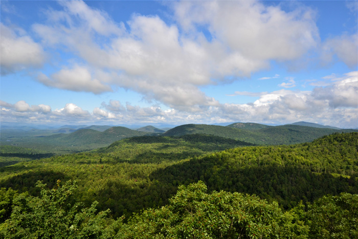
A round-trip hike of 1.9 miles and an elevation gain of only 238 feet, the 1,904-foot summit provides easy access to phenomenal views of the Adirondacks. Located 11 miles east of Brant Lake and 5.5 miles west of Hague on the newly repaved Route 8, this trail will undoubtedly be a fire tower fan favorite in the years to come.
Parking for the trailhead is at a highway turnout on Route 8, overlooking North Pond. Trail access is at the west end of the pond and is clearly marked with a yellow highway sign.
To access the trail, hop over the guardrail to a path that crosses a beaver dam. Poles at this crossing will steady your traverse. Once across the stream, there is a short but steep ascent up the embankment that is probably the biggest climb you’ll encounter. Trail work to add stone steps is planned.
If you are hiking in late July and August, as I was, keep an eye out for wild raspberry bushes, a tiny but delicious trail treat. If you step into the bushes to pick, as I did, be prepared to come out with your legs scratched up, as the thorns are fairly prickly.
Hikers will also come upon occasional timber harvest slash in the recently logged forest. The remainder of the route is well marked and meanders up the mountain through a series of switchbacks.
Trail clearing and hardening done by Warren County crews and volunteers is evident, with some notable rock placement through a wetland area.
At 0.8 miles you will intersect with a service road that trail crews used to get equipment to the summit. Turn right to the summit. (On the way down, be sure to follow trail signs and hang a left at this junction.)
As you approach the fire tower at .88 miles you’ll see the remains of a fire observer cabin. The cabin is in ruins with a collapsed roof, with plans to remove it in the future. Posted signs and some orange netting urge people to keep out.
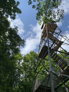
The restored fire tower, the gem you’ve been hiking for, lies just ahead. The seven flights of steps and the top deck were replaced this spring and early summer.
Slide your camera button to pano for views of Gore and Crane Mountains and Brant Lake that are nothing short of breathtaking. Social media will geo-tag Swede Mountain for those who want to share their experience with friends. Look for this to be added to the Adirondack Mountain Club Fire Tower Challenge.
Hikers looking for a trail map can find one on the Warren County Recreation Mapper at https://warrencountyny.gov/gis/maps/Recreation-Maps. Info: 761-6410.
Important note: Warren County owns the fire tower and a parcel of land around it, and the County has an agreement with a landowner to have the trail cross private property to get to the summit. Please respect the pre-existing agreements held by the private property owner through which the trail traverses. Violation of this closure could lead to revocation of the public recreation easement.
Hunting season trail closure dates are from September 10 to December 16, inclusive.
Recommendations: Get there early in the day to assure a parking spot, and hike this trail before it closes on September 10. Your next chance to see the firetower will be December 17, and if you’re like me, you’ll be hoping for snow!
Parking: Limited, at a New York State rest area, off the eastbound side of Route 8. GPS Coordinates are N 43° 44’ 33.009” W 73° 35’ 17.749”.
Joanne Conley is Warren County’s Director of Tourism.
Copyright © 2021 Lone Oak Publishing Co., Inc. All Rights Reserved
 Glens Falls Chronicle Serving the Glens Falls/Lake George region; Warren, Washington and northern Saratoga counties since 1980


